How to Use an MVUM to Find Legal Dispersed Camping
A beginner-friendly guide to Motor Vehicle Use Maps (MVUMs): what they are, where to download them, how to read the legend, and how to use them to avoid illegal roadside camping on National Forest land.
May 19, 2026 / 11 min read
TLDR
- An MVUM (Motor Vehicle Use Map) is the Forest Service map that shows which National Forest roads and trails are designated for motor vehicle travel, often with seasonal dates and vehicle class rules.
- Some MVUMs also show where motor vehicles may leave the road for limited purposes like dispersed camping. If the map does not show that permission (or local orders restrict it), assume you must stay on the road and camp only where specifically allowed.
- Use a simple workflow: pick the forest and ranger district first, download the correct MVUM, check alerts and closures, choose three backup road corridors, then confirm on the ground with signs and low-impact site selection.
- Do not treat an MVUM as a campsite directory. It is a legal travel map, and rules can change by forest, district, and season.
- Campora can help you keep your MVUM link, backup options, fire restriction checks, and the details you want to remember for the next trip.
What an MVUM is (and why it matters for camping)
An MVUM is a Motor Vehicle Use Map. It is a Forest Service map that reflects travel management decisions for a specific National Forest. In plain language: it tells you where motor vehicles are allowed to go on that forest's designated system of roads, trails, and areas.
That matters for dispersed camping because a huge amount of accidental "illegal camping" happens when someone pulls off a forest road because it looks like public land and assumes that roadside vehicle access is allowed everywhere. In many places it is not.
If you want to camp from your vehicle on National Forest land, the MVUM is one of the most important maps to check before you go. It is not always the only document that applies, but it is often the most direct way to avoid guessing.
Where to get the right MVUM for your trip
Start with the exact National Forest and ranger district you plan to visit. MVUMs are not one national map. Each forest publishes its own MVUM(s), and many forests split them by ranger district or by geographic zone.
Look for the forest's official MVUM page, maps page, or "maps and publications" page. Download the PDF for the area you are visiting and make sure the publication date is reasonably current. If you cannot find the MVUM online, call the local office and ask where they publish it or whether there is a newer version.
A practical tip for beginners: download the MVUM before you drive out of cell service, and keep it available offline. If you use a PDF viewer that works offline, you can search the map text and zoom in without a connection.
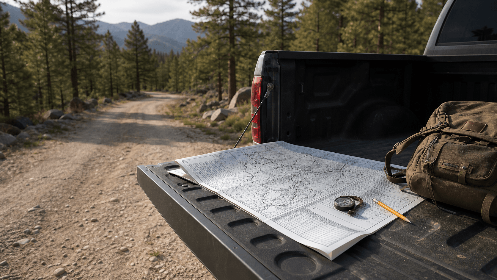
How to read an MVUM without getting overwhelmed
Most beginners struggle with MVUMs because they are designed as legal travel maps, not tourist maps. They can look sparse, and the useful details are often in the legend and the route designation tables.
Before you zoom around the map, do three quick passes.
Pass 1: Find the legend and look for the vehicle symbols and any notes about seasons or restrictions. Many MVUMs define which symbols mean passenger vehicles, high-clearance vehicles, or other vehicle classes. The details are forest-specific, so always read the legend on the exact MVUM you downloaded.
Pass 2: Find the roads/trails you care about and read the route identifiers (names or numbers). MVUMs are usually best used with a second reference map (like a forest visitor map, topo map, or satellite layer) so you can connect the legal route identifiers to the terrain you will drive through.
Pass 3: Check the designation table for those roads. This is where you will often find seasonal dates (for example, roads open only in summer), vehicle class restrictions, or notes about how a route can be used.
The part most people miss: what an MVUM does not tell you
An MVUM is not a list of campsites. It usually does not tell you where good camps are, whether an area is crowded, whether a road is washed out, or whether a shady pullout is muddy after a storm.
It also may not include every closure or rule that affects camping. Fire restrictions, temporary closures, wildlife closures, construction work, and special orders can change faster than a PDF map can be updated.
Use the MVUM as your baseline legal travel layer, then verify the current conditions with the forest's alerts page and local ranger district info.
How dispersed camping shows up on an MVUM (and what to do when it does not)
Some MVUMs include a dispersed camping or "dispersed camping/game retrieval" symbol tied to a road or trail. When that symbol is present, it can indicate limited cross-country motor vehicle use in a specified corridor for that purpose. The key word is limited: the details come from the table and the forest's local rules, not from your assumptions.
Other MVUMs may not show dispersed camping permission at all. When that happens, do not interpret it as "camp anywhere." Instead, treat it as a signal to slow down and confirm how that forest manages roadside dispersed camping. In some areas, camping is allowed but motorized travel off the road is not. In others, you may only camp in designated roadside sites, or the forest may have a special order restricting roadside camping in specific corridors.
If you are new, the safest approach is simple: only camp where the MVUM and local guidance clearly support what you are doing, and follow posted signs on the ground even when the map is unclear.
A beginner MVUM workflow for legal, low-stress dispersed camping
If you want a repeatable process that works across forests, use this seven-step flow. It is not glamorous, but it will save you from arriving after dark with no plan.
1) Pick the land manager and unit first. Identify the National Forest and ranger district. Save the district office phone number as a backup.
2) Download the MVUM for that exact area. Do not rely on an old screenshot or a third-party map layer alone.
3) Check current alerts and closures. Look for road closures, fire restrictions, and camping restrictions. If you are unsure, call the district office.
4) Pick three candidate road corridors (not one campsite). Your goal is to have options if the first area is full, signed no-camping, or too rough for your vehicle.
5) Choose an arrival plan that includes daylight and a turnaround. MVUMs help you avoid illegal travel, but they do not magically create a safe place to turn around or park.
6) On the ground, follow signs and respect closures. If a road is signed as closed, or a corridor is signed no camping, do not try to logic your way around it with a PDF map.
7) Camp only in durable places. Prefer previously impacted spots, do not widen pullouts, do not crush vegetation, and do not create new fire rings.
Quick checks that keep you from getting in trouble (or being that camper)
Stay limits: many public land areas limit how long you can camp in one location. Rules differ by unit, so always verify local regulations, but the common pattern is a 14-day limit followed by a required move.
Fire: check fire restrictions every time, even if you plan to use a stove. Restrictions can change within days, and some areas restrict charcoal, wood fires, or even smoking outside vehicles.
Waste: if there is no toilet, know the human-waste basics before you go. Leave No Trace recommends catholes that are 6 to 8 inches deep and at least 200 feet from water, camp, and trails, and it also emphasizes managing toilet paper appropriately for the place you are in.
Water: do not camp or park right next to streams and lakes just because it looks convenient. Give yourself space from the water and protect riparian areas.
Noise and light: dispersed areas feel wild because they are quiet and dark. Keep it that way for the next person.
If you are on BLM land instead of a National Forest
MVUMs are a Forest Service system. If you are camping on BLM land, your starting point is the local BLM field office rules and the BLM mapping tools for that unit. The same workflow still applies: identify the land manager, confirm the current restrictions, and plan backups instead of relying on one pin.
Common MVUM mistakes (and what to do instead)
Mistake: Treating the MVUM as an optional reference. Fix: make it part of your packing list, like your headlamp. If you plan to drive forest roads, you need the map.
Mistake: Picking one campsite pin and hoping for the best. Fix: pick three road corridors and arrive with daylight so you can choose a legal site without rushing.
Mistake: Assuming "public land" means "camp anywhere." Fix: confirm the unit rules and look for MVUM dispersed camping symbols, corridor designations, or special orders that limit roadside camping.
Mistake: Driving off-road to "make a spot." Fix: use established impacted sites and keep your vehicle on legal routes and legal corridors only.
Mistake: Ignoring seasonal dates. Fix: look up the open season in the route table and have a lower-elevation backup if you are planning shoulder season trips.
How Campora fits into MVUM-based trip planning
MVUM planning works best when it is not scattered across screenshots, browser tabs, and last-minute texts to your group. The goal is a simple, repeatable pre-trip checklist you can reuse.
In Campora, you can save your trip plan with the MVUM link, the three backup road corridors you picked, and a few notes that matter on the ground (for example: "Road 7012 open after July 1" or "No roadside camping on the first 2 miles").
After the trip, you can save the places you loved and the lessons you learned. That way, next time you want a low-effort weekend, you are not starting from scratch.
Sources
- US Forest Service MVUM FAQ
- US Forest Service MVUM definition (PDF)
- Example MVUM legend and dispersed camping symbol (PDF)
- Black Hills National Forest MVUM FAQs (dispersed camping symbol)
- BLM camping guidelines (stay limits and planning reminders) (PDF)
- BLM fire restrictions
- Leave No Trace Principle 3 (Dispose of Waste Properly)
More Campora Guides
View allJuly 21, 2026
How to Store Food While Camping in Bear Country
A beginner-friendly workflow for bear country food storage, scented items, coolers, canisters, lockers, campsite cleanup, and local rules.
July 14, 2026
Types of Camping Knives and What Each One Is For
Learn the main types of camping knives, what each one is best for, and how to choose a safer camp blade for cooking, repairs, and trail use.
June 30, 2026
Camping Food List for Beginners: What to Pack
Build a simple beginner camping food list with easy meals, safe cooler packing, water planning, snacks, cleanup, and wildlife-safe storage.